Severe weather coming: Risk of flash flooding, damaging winds, tornadoes possible
Published 6:29 pm Sunday, March 20, 2022
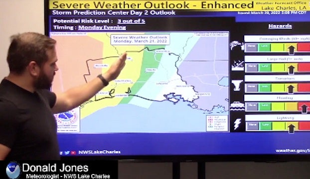
- Donald Jones, a meteorologist with the National Weather Service’s Lake Charles Office said a low-pressure system is expected to produce widespread showers and thunderstorms Monday night and into Tuesday.
Severe weather and flash flooding are possible Monday and into Tuesday as a low-pressure system makes its way through Texas and into Southwest Louisiana.
Donald Jones, a meteorologist with the National Weather Service’s Lake Charles Office said the system is expected to produce widespread showers and thunderstorms.
There’s also a risk of power outages with this system, he said.
“We’re looking at the potential for tornadoes — and some could be strong tornadoes,” he said. “Large hail, damaging winds and flash flooding are also possible.”
The threat will begin in southeast Texas Monday afternoon and eventually shift into Southwest Louisiana by Tuesday morning, extending into south central Louisiana.
He said the system will push a cold front into the area along with the severe weather.
“You may notice some strong winds Monday afternoon, that will have the potential to blow around objects like trash cans around,” he said.
He said Southwest Louisiana is expected to receive the worst of the weather starting around 9 p.m. Monday and the storm could be over by about 3 p.m. Tuesday.
“We are going to have the risk of flash flooding because this is not a very fast system and as it comes in it’s going to pull a lot of moisture from the Gulf that will produce storms.”
Jones said two to five inches of rainfall could be possible.
“Once the cold front comes through, the severe weather will end,” he said.
It will also bring a few days of cooler weather.
“We’ll be looking at breezy conditions on Wednesday and Thursday; it won’t be real cold but it will drop into the 60s during the day and the 40s at night,” he said. “It’s going to be very spring-like and pleasant, but we’ve got to get through this first,” Jones said.