All eyes on Ida: ‘Nothing going to stand in its way from intensifying’
Published 9:52 pm Friday, August 27, 2021
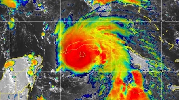
- This satellite image shows Hurricane Ida beginning to emerge over the southeastern Gulf of Mexico after making landfall in western Cuba. (NOAA)
Calcasieu Parish is under a voluntary evacuation order as of Friday as Hurricane Ida makes its way towards the Louisiana coastline. Ida is forecast to strengthen into a major hurricane, possibly a Category four, by the time it makes landfall across South Central to Southeast Louisiana Sunday night.
While Southwest Louisiana remains outside of Ida’s direct path, the current vulnerability of many homes and structures still with tarped roofs and broken windows is the main cause for the voluntary evacuation, Dick Gremillion, director of homeland security and emergency preparedness, said.
“We would not normally call attention to a storm of this nature if we were on a normal year, but this year, as everyone knows, has not been a normal year.”
Parish transit will begin providing transportation to the Burton Coliseum on Saturday, 8 a.m. – 6 p.m., for individuals needing assistance with evacuation outside of the parish.
Individuals within the city of Lake Charles can catch the city bus via regular bus stops on Saturday and those outside of the city can find transportation at the Bell City Fire Station, Southeast corner of La. 27 and La. 12 in DeQuincy, Stine Home and Yard in Sulphur, Iowa High School stadium parking lot, Tractor Supply in Moss Bluff, Starks VFW, Kroger’s parking lot in Sulphur, Love’s Travel Stop in Vinton or the Westlake Recreation Center. Dial 211 if assistance is needed to get to a pickup location.
Lake Charles Mayor Nic Hunter said citizens should be vigilant regarding the current state of their housing. “A lot of structures in this community are compromised. Homes people might be living in are not today what they were pre-Laura,” he said.
“We’re giving you an option, but tomorrow is really your only opportunity. Tomorrow is your window. If you’re concerned about the safety of you and your family, take that opportunity tomorrow.”
With tropical storm force winds expected to reach between 40 and 60 miles per hour, Gremillion especially warned those living in temporary housing units. “We have thousands of people now living in mobile homes and travel trailers. If they’ve not secured them properly, then even 40-60 miles per hour winds potentially for this storm could affect some of those structures.”
Andy Patrick, National Weather Service meteorologist, said Ida is expected to merge off of Cuba overnight and then rapidly intensify. “Frankly nothing is going to stand in its way from intensifying, we think, very significantly over the next 24 to 36 hours,” he said.
Ida’s track “could shift or wobble a few miles east or west” but Southwest Louisiana’s major concern will be “mainly of the tropical storm variety,” Patrick said. Tropical storm force winds are expected to begin Sunday night after sunset, linger into the morning and diminish Monday morning.
Residents further west will experience winds up to 30 miles per hour and those further to the east potentially 60 miles per hour. There are no concerns about storm surge and rainfall is expected to reach between one and three inches from rain bands beginning as early as Sunday, Patrick said.